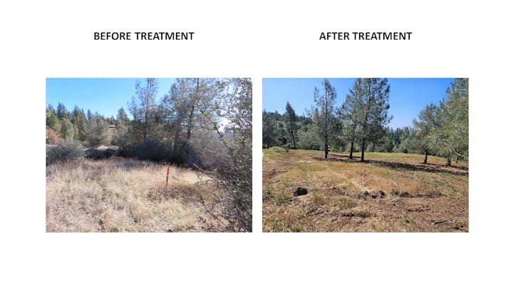
Technical Assistance Available for Forest Health Assistance Program (FHAP)The Amador Resource Conservation District (ARCD) is offering technical assistance to landowners in Amador, Calaveras, and Tuolumne Counties for Forest Health and Fuels Reduction.
Murphys-to-Forest Meadows WUI Fuel BreakThis project will create a shaded fuel break across four noncontiguous units totaling 732 acres. All four units are located on the south side of State Highway 4 between Murphys and Forest Meadows (aka the Ebbetts Pass Corridor, a designated scenic byway). The entire project is on private land, impacting 95 private parcels, with approximately 50 habitable structures.
Forest Meadows/Wylderidge Fuels Reduction ProjectThe project would reduce fuels on 174 acres and extend the existing fuelbreak network, providing protection for the northern and eastern sides of these developments as well as surrounding homes interspersed along the Utica Grade and in Hathaway Pines, Avery, and Arnold.
Hwy 108 North/Fricot City Road Fuel Reduction ProjectThis project will consist of two hazardous fuels reduction projects: the Highway 108 North fuel break in Tuolumne County, and the Fricot City Road fuel break in Calaveras County.
Pine Ridge- Summit Fuelbreak MaintenanceThe Pine Ridge Summit Fuelbreak Maintenance Project (Project) is a 144-acre fuels reduction project in central Calaveras County near the communities of Railroad Flat and West Point. The applicant, the Calaveras County Resource Conservation District (CCRCD), will implement the Project with assistance from the Cal-Am Forestry Team. The Project is located completely on private property and widens and…
Bummerville/Blizzard Mine Fuels Reduction and Forest Restoration ProjectThe Bummerville/Blizzard Mine Fuels Reduction and Forest Restoration Project (Project) is an implementation project in northern Calaveras County near the communities of Bummerville and West Point. The applicant, the Calaveras County Resource Conservation District (CCRCD), will complete 460 acres of ladder fuel reduction and forest thinning on Bureau of Land Management (BLM) parcels within the…
Mokelumne Hill Fuels Reduction ProjectThis flammable fuels reduction project will provide fire prevention to Mokelumne Hill. There are live and dead fuels in the Mokelumne River Canyon and the busy state highway in the canyon exacerbates the potential of ignitions. Mokelumne Hill is a town of approximately 1,400 persons. The Treatment Influence Zone is 345 acres, and Project Influence Zone is 47,900 acres.
RCPP Crisis to Opportunity: Tree Mortality in the Central SierraA New Opportunity for Private Non– Industrial Forest Landowners
732-acre shaded fuel break in the works between Murphys and Forest MeadowsDue to the increase in wildfire in recent years, the state and local organizations have stepped up efforts to mitigate risk through forest thinning, controlled burns and the establishment of fuel breaks.
WILDLIFE BIRD BOX GRANTAmador, Calaveras County and Tuolumne Counties received a subgrant through the California Association of Resource Conservation District’s (CARCD) “Habitat Restoration Through Climate Resilience” grant…
Additional GrantsSince our RCD receives no support from County or State agencies, we are funded by the competitive grant process.