
Pine Ridge - Summit Fuelbreak Maintenance - COMPLETED
Pine Ridge-Summit Level Fuelbreak Maintenance Project SNC #1284
Before and After Photos


Before and after photos of the eastern end of the fuelbreak where Summit Level Rd intersects Swiss Ranch Rd. Standing at the intersection looking east.
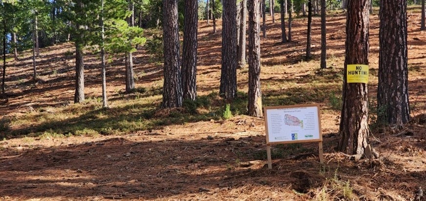
Signs place at the eastern end of the fuelbreak at the intersection of Summit Level Rd and Swiss Ranch Rd.

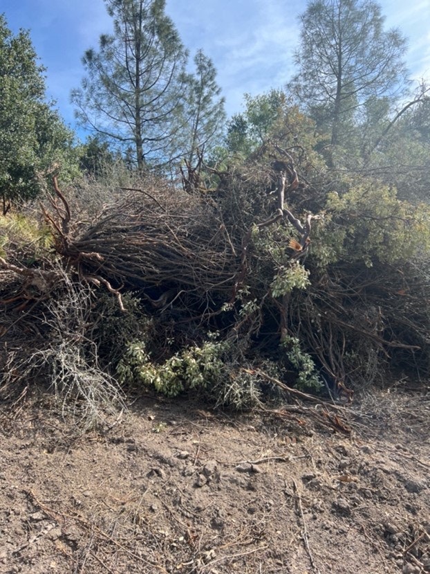
Hillside contingency line made more permanent into a full functioning fuelbreak now accessible by 4wd vehicles. Before photo shows a pile that was made at some point and after shows what it looks like after the contractor treated it and spread masticated vegetation onto the ground.
Before and after views of the west end near Rail Road Flat Rd just south of Calaveras Reservoir.
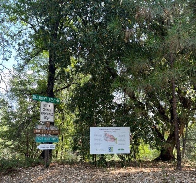
Sign placed at the very west end of the fuelbreak near Rail Road Flat Rd at the intersection of Top Dollar Rd and McCarthy Reservoir Rd.
Pine Ridge Project - In the Beginning
The Pine Ridge Summit Fuelbreak Maintenance Project (Project) is a 144-acre fuels reduction project in central Calaveras County near the communities of Railroad Flat and West Point. The applicant, the Calaveras County Resource Conservation District (CCRCD), will implement the Project with assistance from the Cal-Am Forestry Team. The Project is located completely on private property and widens and strengthens a strategic fuelbreak installed during the 2015 Butte Fire.
Ranging in elevation between 2,000 and 4,000 feet, the Project footprint is 150 feet wide and six miles long. Dominant vegetation is chamise, whiteleaf and greenleaf manzanita, California black and Oregon white oak, and Pacific madrone. The Project takes advantage of a strategic bulldozer line installed during the 2015 Butte Fire to establish a six-mile-long fuelbreak that is 150 feet wide. The treatment will consist of a near complete removal of ladder fuels and trees less than 10 inches in diameter. The prescription will be a mixture of hand thinning and mechanical mastication, where slopes allow. Hand thinning units will use towed or track chippers to dispose of slash and spread mulch across the fuelbreak to reduce brush sprouting. On the steepest of slopes, a lop and scatter technique will be used. The fuelbreak connects to Railroad Flat Road on the West and Summit Level Road on the east.
Multiple goals of the SNC Strategic Plan are met with this Project. The Project helps protect watershed and community resources and builds the capacity of California’s newest Resource Conservation District. Implemented within the Calaveras River Watershed, the Project adds needed protection to a typically underrepresented watershed within the Region. The Calaveras River flows into New Hogan Reservoir and ultimately into the San Joaquin River. These water resources are used primarily for irrigation, but also for municipal water supply and power generation.
Project Cost: $405,605
